The Ramsay Project is investigating naturally occurring hydrogen
Our current focus is the Ramsay Project – a 100% Gold Hydrogen-owned exploration project in South Australia.
During the 1920s and 30s, South Australian State Department geologists reported finding natural hydrogen gas while exploring for oil.
More than a century later, we have looked at these results with a new understanding that naturally occurring hydrogen could be the key to unlocking a revolutionary low-cost fuel source.
Gold Hydrogen was awarded petroleum exploration licence (PEL) 687, after we provided the historical evidence for natural hydrogen occurrences of greater than 80% purity.
Our early testing in 2023 has proved not only that that hydrogen level still exists, but that there are also positive results for helium.
Ramsay Project objectives were:
- Initially validate the natural hydrogen occurrences of the 1920s and 1930s and prove that natural hydrogen is present within our tenements. We drilled at two of those sites in late 2023, and they yielded high purity levels of up to 86% hydrogen, plus helium in high purity levels at up to 17.5% (air-corrected). These purities were verified by our well testing campaign during 2024.
- Demonstrate that natural hydrogen is present in sufficient volumes to be extracted for commercial use. This remains a critical focus of our ongoing exploration efforts as we aim to optimise our drilling locations as well as our drilling and extraction techniques.
Ramsay Project proposed seismic survey activity
Gold Hydrogen will continue its exploration program by undertaking a 2D seismic survey using public roads on the southern Yorke Peninsula from mid-June to mid-July 2024. There will be minimal requirement to access private land and Gold Hydrogen have consulted with the small number of landowners where survey activities will be undertaken on their properties.
Approval for the seismic survey has granted by the South Australian Department for Energy and Mining and the relevenat documents for this work can be found by clicking on the links below.
A fact sheet that has more information about the seismic survey can also be found below.

Typical onshore seismic survey outline
(Source: APPEA, 2019)
Ramsay Project exploration drilling activity
The South Australian Department for Energy and Mining has approved Gold Hydrogen’s Environmental Impact Report and Statement of Environmental Objectives for exploration drilling activity on Yorke Peninsula Petroleum Exploration Licence 687. Our first two exploration wells Ramsay 1 and 2 were drilled in late 2023 and further wells are being planned for late in 2024 or early 2025.
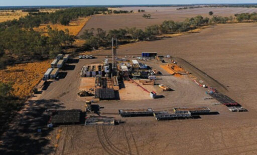
Example of an onshore drilling rig.
Yorke Peninsula aerial survey
Gold Hydrogen is hoping to prove natural hydrogen resources, first identified between 90 and 100 years ago, can be developed to provide clean energy.
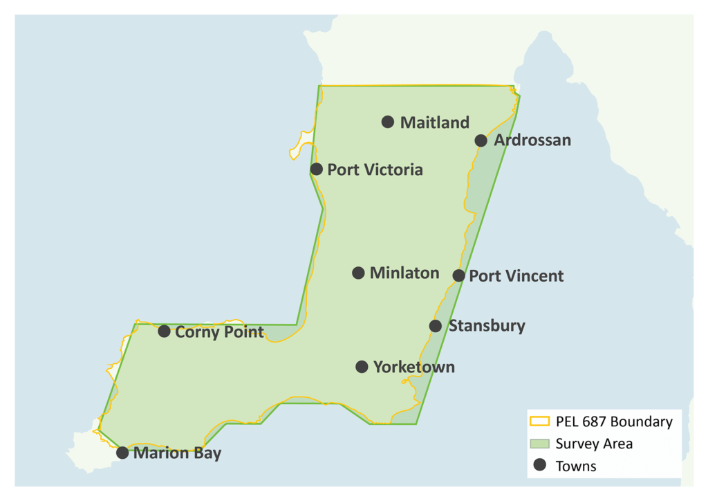
As part of its licensed exploration activities, GHY is planning to carry out an airborne gravity-magnetic survey to obtain geoscientific data within the Yorke Peninsula section of the licence area during March 2023.
Why is the survey being undertaken?
Airborne gravity-magnetic surveys measure and capture natural variations in the strength and other characteristics of the Earth’s gravity and magnetic fields. This information will assist GHY geoscientists to understand the sub-surface geological structures in the licence area.
How will the survey be taken?
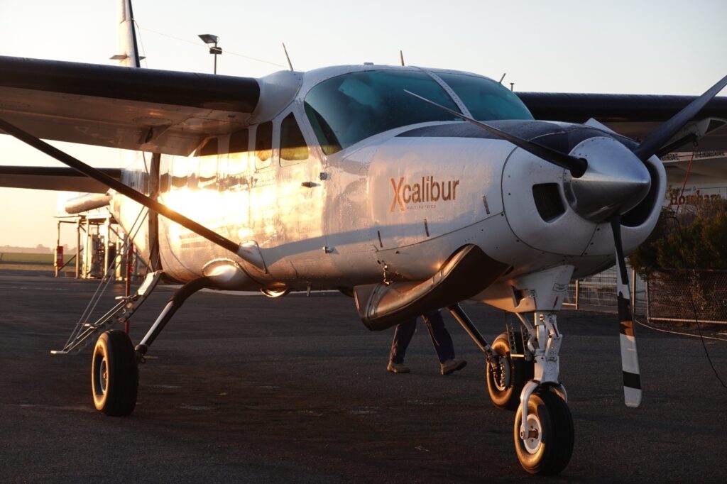
The survey will be carried out by a fixed wing light aircraft fitted with instruments that can detect small variations in the force of gravity and natural magnetic fields. The aircraft is operated by Xcalibur Aviation Australia, a company that specialises in airborne geoscientific surveys.
What might you see?
The survey will acquire approximately 10,000-line km of gravity-magnetic data in daylight hours along a flight path of parallel lines spaced 500 metres apart in the area marked in green on the map.
What might you hear?
Noise levels on the ground will be audible but transient and less than the sound of a passing motorbike.
Soil gas survey
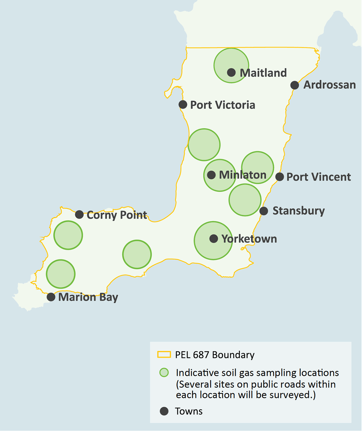
Gold Hydrogen will be carrying out a non-invasive soil gas survey over the southern portion the Yorke Peninsula in South Australia within its granted licence area for approximately two weeks during mid-late April 2023. The Commonwealth Scientific and Industrial Research Organisation will be doing the soil-gas survey for Gold Hydrogen.
Why is the survey important?
The survey is designed to detect natural hydrogen generated from various geological processes that could be occurring in parts of the Earth’s crust in the survey area. This information will assist Gold Hydrogen geoscientists understand where very small amounts (parts-per-million) of natural hydrogen could be leaking to the surface and its relationship to other subsurface geological observations. It will help generate a broad picture of the presence of hydrogen in soil.
What you may see or hear
During survey activity you may see:
- A light vehicle operated by CSIRO stopped along the road easement at pre-determined survey points. Samples will be taken from road verges and easements.
- High-vis field technicians with handheld gas-soil survey equipment.
Soil gas survey method
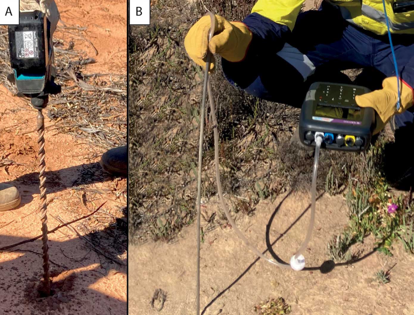
A small handheld hammer drill, similar to the type of equipment you might use at home or on a farm, will drill a hole up to a metre in depth into the soil within the road easement. A tubular instrument will be inserted into the hole to determine if hydrogen gas is present.
This is a non-invasive activity and noise levels on the ground will be minimal.
Survey area
Approximately 80 survey points have been identified in a wide locality (see map). Several sites on verges/easements on public roads within each location will be surveyed.


